

 |
Tourism and heritage |
| Activities and leisure | |
| Sightseeing tours | |
| Campsites | |
| B&Bs/Apartments | |
| Stopover gîtes | |
| Hotels | |
| Restaurants | |
| Events | |
| Traders and artisans | |
| Getting here | |
| Contact us |
 |
More information |


 |
Listing |
Tourism and heritage
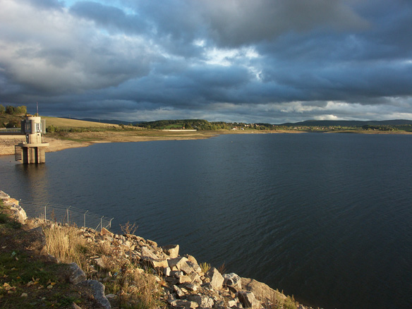
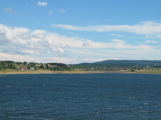
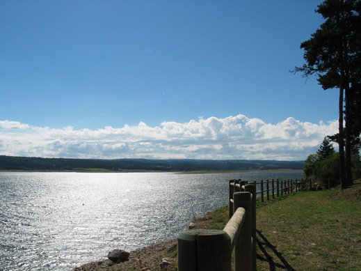
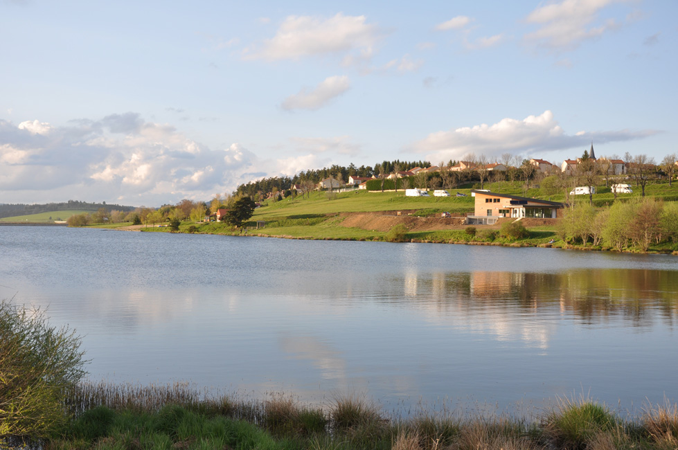
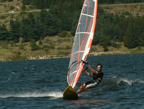
Naussac lake
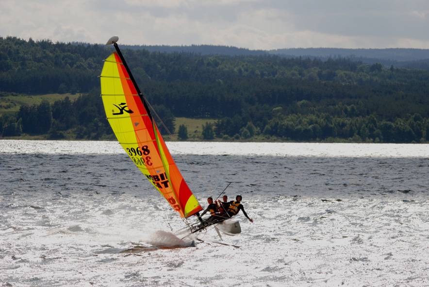
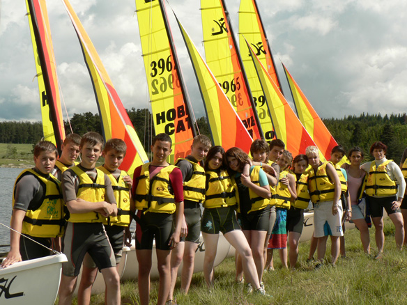
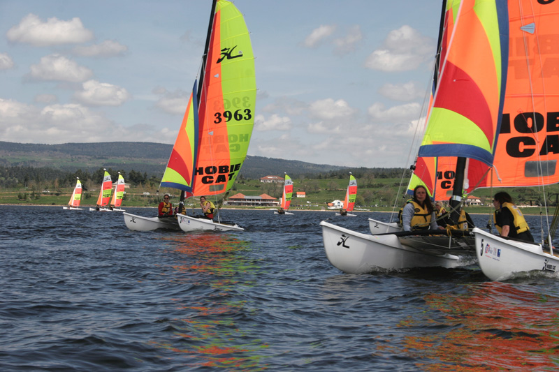
A site to visit at all seasonsA 1050-acre interior sea, the Naussac Lake is an essential centre for sporting and discovery activities.Choice of activities on and around the LakeNautical activities :Sailing, windsurfing, kiteboarding, canoeing, kayaking, canyoning, fishing.Two nautical centres (rentals, courses, and lessons), one nautical club, which organizes regattas from May to September, and a fishing centre (boat rental, courses, and lessons.) Beach with lifeguard patrol in July and August, pedal boat rentals. White water activities :Rafting, canoeing, riverboarding, sea kayaking, canoe trekking, canyoning, on the Lake or in the Allier Gorges.Hiking activities :Mountain bike, on foot, horseback and orienteering centre.But also :Mystery adventure forest and biking parks, golfing, potholing, rock climbing, hunting...
Find out more by visiting our Activity and Leisure page Hiking/Mountain biking Map published by the Tourist Office: 3 €Mountain bike itineraries from the Espace VTT-FFC du Gévaudan #50 and hiking itineraries (10 PR = short hikes).« GPS itineraries’ »With 2 itineraries leaving from the Naussac Lake, discover either the wildlife or the history and legends of our region.For all the family, with a 1-hour and a 2 hour 30 circuit. " Tree and Shrub discovery itinerary’ " :This easy itinerary will enable you, in one kilometre and one hour, to discover the thirty or so trees and shrubs that grow around our commune. Most of them grow there naturally, and some of them, planted by Auroux locals, have managed to thrive although the altitude and climate widely differ from their usual biotope.You will find green signs with a white number, and also lengths of numbered tape nearby, matching the numbers of the trees given in the leaflet, so you can spot them more easily. Booklet available for 3 € at the Syndicat d’Initiative in Auroux and at the Tourist Office in Langogne.
Topographical guides for sale in bookshops :Guides by the Fédération Française de la Randonnée Pédestre (French Hiking Federation). www.ffrp.asso.frRegional GR (Hiking trails) / GR 4 "Des Gorges de l’Ardèche à la Margeride" (Reference 407) Regional GR "Tours en Margeride" (Reference 480) GR 70 "Stevenson’s Path" (Stevenson’s Path) (Reference 700) GR 700 "The Régordane Road (Voie Régordane)" (Reference 7,000) Guides by Chamina Editions: www.chamina.com "Margeride et Gévaudan" "Vallée et Gorges de l’Allier" |

 |
Quick Search |
